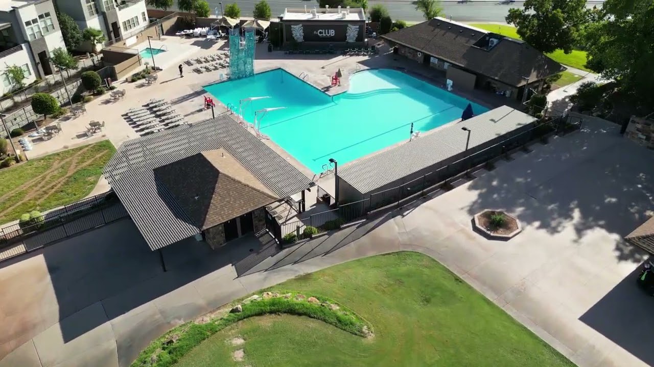
The whole site, from directly above.
Planning a layout from a street level photograph means guessing. A top down image of the actual site, at high resolution and in one piece, turns that guessing into measuring off something real.
We fly the property, stitch the passes into a single top down image, build a 3D model alongside it, and hand back an annotated map you can mark up and circulate.
What you get.
- Airspace check
- Your address is checked before scheduling. If it needs an authorization on file, we tell you the lead time up front.
- Top down imagery
- An orthomosaic, which is many overhead frames stitched into one high resolution image of the whole site.
- 3D model
- A model file of the site, useful where a flat image cannot show grade, height, or how areas sit relative to each other.
- Annotated site map
- A PDF with the areas you care about labelled, ready to mark up and send to a crew, a vendor, or a client.
- Repeat visits
- Flown to the same paths and angles, so documentation across a project actually compares.
- Scope
- Provided for planning, marketing, and documentation purposes. Not a boundary or land survey.
$800
One site, one visit. Top down imagery, 3D model, and the annotated map. Scheduled repeat visits across a project are quoted as a set.
All figures are starting points, not quotes. Every project is scoped and priced after a fit call.
Who books this.
Event producers
Laying out a footprint on a real site plan instead of a sketch, before anything gets trucked in.
Landscape architects
Existing conditions documented in one image, at a resolution worth designing against.
Construction and property managers
Progress documented on a schedule, from the same angles, so the record holds together.
Common questions.
Is this a survey?
No, and we will not describe it as one. This is imagery and documentation for planning, marketing, and record keeping. A boundary or land survey has to be performed by a licensed surveyor, and in Nevada and Texas that is the law, not a preference. If your project needs one, hire one.
Can we measure off the imagery?
People do use it for rough planning distances, and it is far better than eyeballing a street photograph. We do not certify measurements, and nothing here should be relied on for legal boundaries, permitting, or engineering.
Can you document the same site repeatedly?
Yes, and that is where this earns its keep. Repeat visits are flown to the same paths and angles so the images compare cleanly across a project.
What if the site is in controlled airspace?
Most useful sites are. We check the address and file the required authorization. Some need lead time and a small number cannot be flown at all, and we say so before taking a booking.